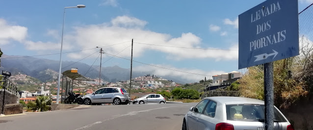
The Levada dos Piornais is reputedly one of the oldest functioning levadas on Madeira and, as its final surface appearance is just to the south of the Barreiros football stadium in Funchal, it's one of the most accessible to many visitors. It formerly continued along two terminal branches whose courses are now roads with names reflecting their history - Rua da Levada dos Barreiros and Levada dos Ilhéus, but now enters a series of tanks and pipes on the far side of the Ladeira da Casa Branca.
The source of the levada is the Ribeira dos Socorridos - the river which runs in the deep gulf that separates Funchal and Câmara de Lobos and which in turn begins close to the Pico das Torres and flows down through Curral das Freiras before finally reaching the sea near Câmara de Lobos.
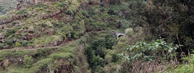
The initial part of the levada, from its source, is dangerous and inaccesible. A further stretch clings precariously to the side of the valley of the Ribeira dos Socorridos, sometimes on a narrow ledge, sometimes in short and cramped tunnels and sometimes apparently hanging in thin air over the precipitous drop beneath. In this stretch there are handrails and barriers where you need them, but not always where you might want them: you have to be sure-footed and have a head for heights. There's also an impressive bridge where the levada takes a short cut across a broader part of the valley. As the levada approaches Câmara de Lobos, it turns back inland, following a safe horseshoe path around the next valley east, through cultivated fields of bananas, before passing under the Via Rápida heading for Papagaio Verde and Amparo and ultimately the urban streetscapes above Ajuda and the Lido before disappearing underground.
You can walk out and back from Funchal (as far as you feel comfortable) or there are various places along the route where you can find alternative transport. It's also possible to walk down from Madeira Shopping, though you will find you arrive at the levada at one of its more uncomfortable sections.
There are sections of the levada where there are trailing pipes and missing covers where the path is on top of the watercourse as well as steep drops, so some caution should be exercised throughout.
We'll start the route from the centre of Funchal, which will be the most convenient access for many visitors.
You can't miss the Barreiros stadium and just at the southern tip where
the Rua da Levada dos Barreiros meets the Ladeira da Casa Branca,the levada dives under the road, never to be seen again.
You can either descend the stone steps onto a rather narrow path, or follow the road - the levada runs a little below its level.
After a short while, the levada turns away from the road and you will have to follow along it as it follows a course roughly parallel to the Estrada Monumental - though at a significantly higher elevation. You will have to pick your way through residential areas where the levada occasionally disappears below a street and comes up on the far side - or thereabouts!
Shortly, the views open out as you pass through some urban farmland that has yet to be built upon. As you pass above Ajuda and the Forum da Madeira shopping centre, the levada meets a set of steep paths and staircases (Escada do Pico da Cruz) that provide alternative access/egress. A little further and you pass the Casa da Levada (a coffeehouse/bar) before the levada crosses under the Caminho do Amparo.
You have to cross the road and go a little way uphill to find the levada access and it is only a short way before the levada dives under the Avenida do Amparo.
Once you're past this section, you're starting to leave the hustle and bustle of Funchal behind.
There are a few places where you can ascend to Papagaio Verde or descend to the Estrada Monumental. A little further on, the levada is crossed by the Caminho do Areeiro and the path and the levada diverge. You need to cross the road where indicated by the signs:
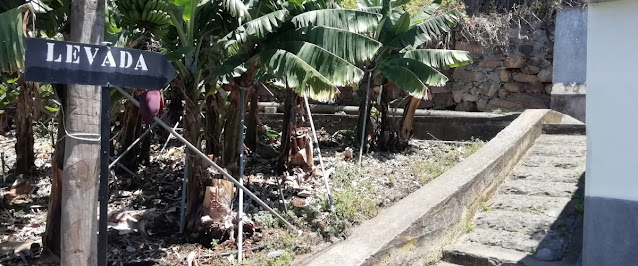
You walk for a short distance down what appears to be the access to someone's house, with banana trees to one side. The levada path resumes after a short detour around the house:
The path of the levada passes beneath a modern building before its course is interrupted by the Via Rápida and you have to ascend some steps to get to the Caminho das Quebradas de Baixo. The official route involves crossing under the Via Rápida and rejoining the levada by walking through Santa Rita, but it's a confusing route with narrow pavements and awkward crossings. A more pleasant option is to turn left and head down the hill until you find the Rampa das Quebradas de Baixo:
The road ends in a narrow path that leads to a bridge over the Via Rápida. Turn left at the end of the bridge and you'll pass a public water fountain where you can top up your water bottle. The levada then resumes on the other side of the road as indicated by the sign:
The levada then follows a horseshoe course around a valley largely devoted to agriculture.
A couple of (long and steep!) staircases lead up to the Pico do Funcho area and at the centre of the horseshoe the levada crosses the
Caminho da Cova to Til. As the circuit of the valley is complete, the path approaches the Via Rápida again where there is a bridge carrying the
Rua do Pico da Lombada over it. If you don't want to continue along the levada, you can cross the bridge and follow the road downhill to the Ponta da Laranjeira roundabout where you can either catch the HF1 bus back to Funchal or walk a little further to the
Passeio Público Marítimo.
 |
| © OpenStreetMap
contributors |
If you do choose to continue, this is where the path starts to get a bit more tricky. The levada enters the valley of the Ribeira dos Socorridos
and shortly enters a series of tunnels that cling precariously to the
valley side. There is a path down before you get to this point and you
can climb back up just beyond this section. You can see the detour on the map (left).
Beyond the tunnels, there are steep drops by the side of the levada and a
general absence of handrails. I met a couple who'd braved the tunnels
but had found their head for heights deserting them at this point. If
you go further, you can see the historic bridge that carries the levada
over another watercourse at height (introductory picture on this page) but are approaching the point where
further progress is inadvisable.
If this is your limit, you do have a potential alternative rather than simply turning back the way you came.
The path on the left of the picture (looking north) is the one coming up from the tunnel detour. The path on the right climbs up towards
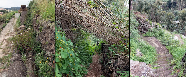
Santa Quitéria. The uphill path provides access to (and from) the parking and transport at Madeira Shopping - when it's passable. When I took the route in March 2023, the path was overgrown, but just about usable, despite a discarded fridge-freezer, some fallen vegetation and being very slippy underfoot. Other reports suggests it's often in an even worse condition. It was clearly once better maintained as there are vestiges of old street lighting.
However, it you are able to get through, there are some interesting remnants of previous water infrastructure, though the route is not marked. You can see part of the route in the pictures below.
 |
| Path from Santa Quitéria |
Getting there
HF bus 45 (from Rua Conselheiro in Funchal) stops close to the levada by Barreiros stadium (stop 815). There's a variety of parking around the stadium.
HF bus 4 (from EEM / Avenida do Mar in Funchal) stops on the Caminho do Amparo (stop 63) where the levada crosses the road.
HF bus 24 (from EEM / Avenida do Mar in Funchal) stops on the Caminho do Areeiro (stop 897) where the levada crosses the road.
HF bus 3 (from Rua Conselheiro in Funchal) stops in Santa Rita just before the levada path resumes after crossing the Via Rápida (stop 885).
HF bus 1 will take you back to Funchal from Ponta da Laranjeira (stop 836) if you leave the levada via the Rua do Pico da Lombada and Caminho da Lombada.
HF buses 8 and 16 (among others) will take you to/from Madeira Shopping. A small proportion of the number 16 buses also serve the Caminho da Cova to Til (see HF timetables).


